Riviera Zadar - Tourist guide
Zadar riviera Croatia - Choose the destination for holidays and make reservations on-line. Check our offer of cities, towns, coves and islands through thousands of our photos!


The coastal belt of this litoral includes the places on the Adriatic Coast Road and a number of them connected to it by short access roads. Following this road from north-west to south-east, we begin at the majestic Maslenica bridge, which spans the deep, narrow straits and connects Novigrad sea with the Velebit Channel. A number of small villages huddles along the coast under the Velebit mountain ranges.
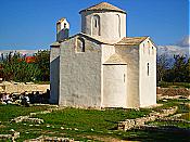
On a somewhat broader expansion of flat land is located Starigrad today largely engaged in tourism because, in addition to its attractive coastal belt, in its immediate hinterland is the National Park Paklenica which attractes numerous tourists. It is the oldest national park in Croatia, established in 1949. Along with its various mountanious krast geomorphology and its specific flora and fauna the park is characterized by two deep canyons, Large Paklenica (14 km) and Small Paklenica (12 km) which cut vertically into the Velebit massif. To the south is the village Rovanjska with the very interesting pre-Romanesque church of St. George from the 11th century.
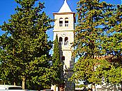
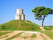
The picturesque town of Novigrad is located on the soutrheasteren side of Novigrad Sea alongside a relativgely long, winding bay. On the top of the hill one will find the ruins of the fortified Medieval city which belonged to the Gusic-Kurjakovic family. To the northwest of Zadar, in a shallow lagoon on sandbanks, almost entirely encircled by the sea, lies town of Nin one of the most important historical places of the entire region. From the 9th century this is where the court of Croatian rulers and the seat of the Croatian bishops was located. The most important, wholly preserved, monument from this period is the church of the Holly Cross.
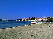
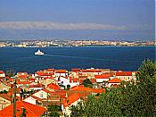
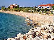
A number of settlements and the city of Biograd are to be found on the relatively low, easy to climb shore on the Zadar maritime coastline. Today mostly a tourist centre, Biograd has played a significant role in Croatian history. From its founding it has belonged to the Croatian ethnic and cultural base. Not far from Biograd is Vrana Lake, in reality a flooded krast field. The Roman city of Zadar received its water from there by way of a aqueduct. The Vrana lake is today a well-known ornithological preserve for numerous species of marsh birds. Recently it has been declared a natural park.
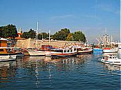
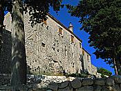
The many islands of the Zadar region are very diverse and arranged in front of the Zadar coastland in three rows. In the front row, relative to the coastland, are the islands of Ugljan and Pasman. The whole of Ugljan but especially the settlement of Preko, located directly opposite to Zadar, are a kind of city outskirts, pslaces directly gravitating to their domicile city and very intensively connected by ferry boats. All of the seven settlements on the island of Pasman are primarily engaged in agriculture. The sea passageway Mali Zdrelac between the islands of Ugljan and Pasman has been bridged over. The Benedictine monastery of St. Kuzma and Damian is located on Cokovac hill over the town of Tkon, the largest of the island settlements.
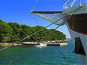
The largest of the Zadar islands is Dugi otok. It is without doubt one of the most beautiful and picturesque of the Dalmatian islands. At its southeastern tip its shoreline is indented into Telascica bay, about 10 km long which itself has smaller inlets and isles. Telascica is today a protected natural park. The remains of the large concentration camp which the Italin army constructed during the occupation of Dalmatia in WW II, interning under unbearable conditions a couple of thousands of people, mostly old men, women and children, are to be found on the island of Molat. On the faraway island of Silba one can still today see beautiful examples of fich houses, mostly, from the 18th century which were owned by sea captains or ship-owners.